Architects & Planners
Obtain quickly all key insights to fully understand a space and to use its resources to create stronger building designs and better urban plans.
Obtain quickly all key insights to fully understand a space and to use its resources to create stronger building designs and better urban plans.
Use data to select sites and to define specifications that transform environmental potentials into long-term sustainable value.
Engage at the pre-design stage to support the definition of smart energy strategies matching the building demand with renewable supply.
Switch to desk for demo with GUI
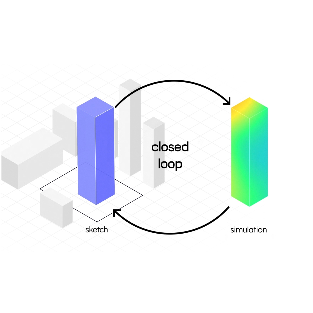
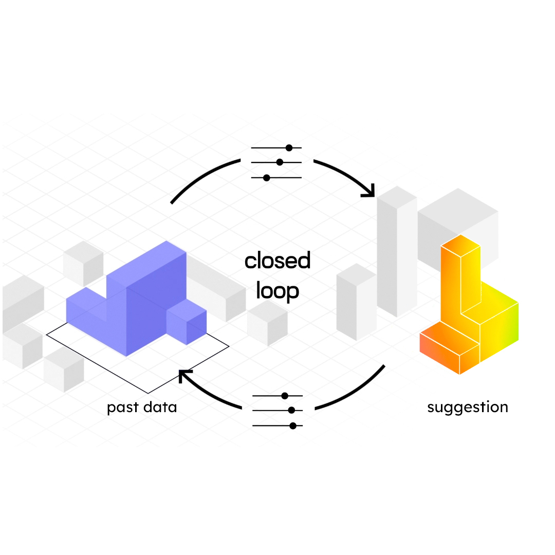
Traditional tools are trapped in a chicken-egg problem: you need a building design to run simulations, while the aim would be to use simulation results to define the initial building sketch. This limits the creation of truly innovative and better solutions. Similarly, AI-tools provide black-box probabilistic suggestions based on past data that are non-innovative and mediocre by definition. UrbanMetrix breaks these self- and past-referential loops opening to the full-exploitation of the local environmental potentials. Starting from top positions and directions a multitude of efficient site-specific solutions can be created under the full control and understanding of the user.